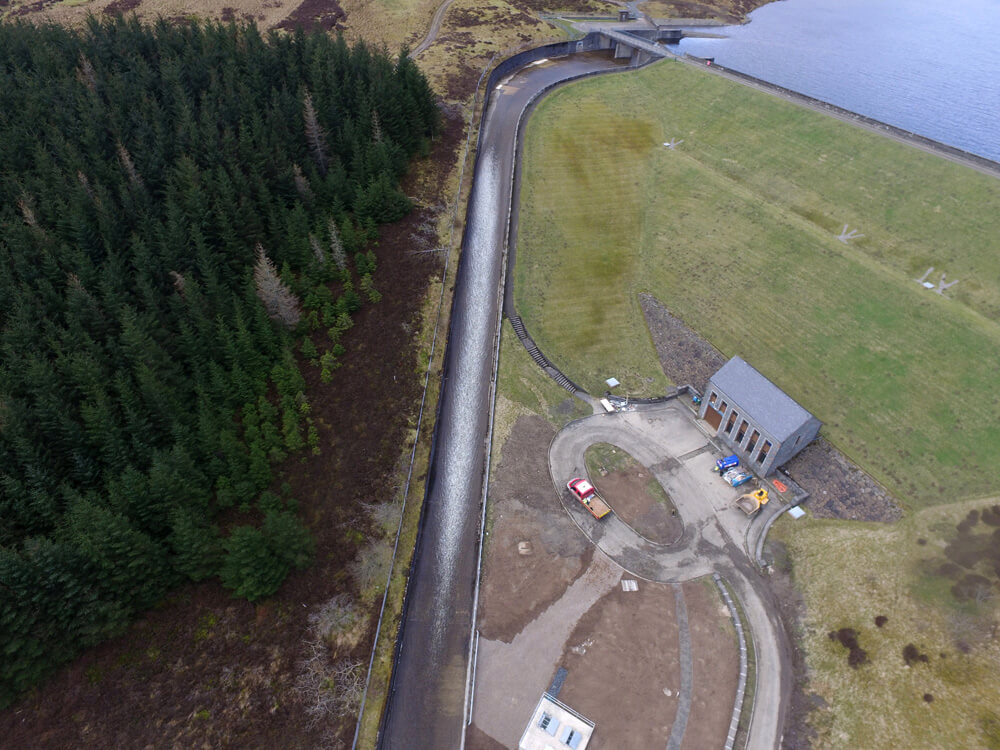
Aerial Mapping
What is aerial mapping?
Aerial mapping is the process of using aerial photography or other remote sensing methods to create detailed maps of a specific area.
- Centimetre accurate drone surveys and inspections – for all industries
- Highest safety standards – fully insured with £5m Public Liability
- Comprehensive and reliable data from industry leading reporting software
Call 01329 887 337 for more information or to request your fast, no-obligation quote.
This mapping can be used in a variety of industries, including land surveying and agricultural planning. With recent advances in drone technology, it is becoming increasingly popular as it offers lower costs and greater precision compared to traditional mapping methods.
Compared with traditional mapping techniques such as satellite imagery and aircraft photography, mapping with drones offer exceptional versatility, flexibility and resolution to capture data in even the most challenging environments.
Whether it’s mapping a construction site or analysing crop growth, aerial mapping allows for unparalleled insights into the landscape from above.

What can I do with aerial mapping?

Construction
Aerial mapping technology offers unique advantages for construction project planning and progress monitoring.
Using drones to capture overhead images, detailed mapping can be completed quickly and safely, without the need for lots of on-site personnel. This mapping can then be used to control costs, track construction progress, and plan logistical operations with precision.
In addition, it can also aid in identifying and addressing potential hazards, ensuring a safe working environment for all involved.
As the construction industry continues to incorporate innovative technologies, aerial mapping is proving to be a valuable tool for streamlining operations and increasing efficiency.
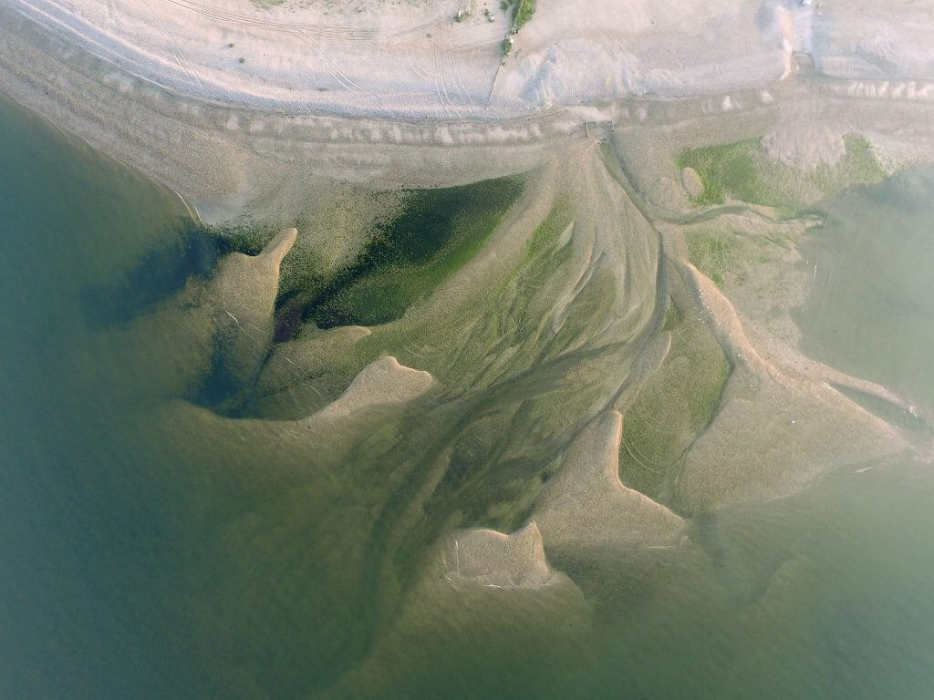
Ecology
The mapping of ecology habitats is essential for monitoring and preserving biodiversity. Traditional mapping techniques, like ground surveys, can be time-consuming and potentially harmful to wildlife. Aerial mapping, on the other hand, uses aerial imagery to quickly and accurately map a landscape’s ecology habitats.
This technique can provide valuable insight into the distribution and health of wildlife populations, as well as pinpoint areas in need of conservation efforts. It can also assist with environmental impact assessments and inform land management decisions.
In short, aerial mapping is a crucial tool that helps us better understand and protect our ecological resources. Drones are increasingly being used for this mapping process as they offer improved accuracy and greater accessibility to remote locations. Overall, it offers a practical solution in the preservation of our precious ecological habitats.

What can we deliver?
We can deliver high resolution
- Orthorectified imagery to provide detailed visual data
- Topographic maps for understanding the layout and content of the land
- Detailed site plans with up to date visual data showing your facility
- Current hazard plans for inductions, site management and safety briefings
- Large format wall imagery for displays, inductions, planning and logistics exercises
As a RICS Technology Partner, we pride ourselves on advising you on both the best and the most cost-effective solutions for your project. We can provide comprehensive advice to solve any problems you encounter whilst undertaking your routine and project specific tasks. If you have any questions, please reach out at any time.
Our Aerial Mapping Process
Every aerial mapping project starts with a clear understanding of your site and objectives. Before any flight takes place, we assess access constraints, site activity, safety controls and the level of accuracy required. This planning stage ensures the right equipment, flight method and data outputs are selected from the outset.
Data capture is carried out by trained surveyors using RTK-enabled drones and calibrated ground control where required. Flights are planned to maintain consistent overlap, altitude and coverage, allowing us to collect reliable data even on active or restricted sites. All operations are completed in line with CAA requirements and site safety procedures.
Once data capture is complete, information is processed in-house using professional mapping and modelling software. Outputs are checked for accuracy before delivery, ensuring the final data can be used with confidence for planning, reporting and decision-making across the full project lifecycle.
Benefits of Aerial Mapping
Aerial mapping offers clear operational and commercial benefits across construction, land management and environmental work. It allows project teams to access accurate information without the delays and risks linked to extensive ground-based surveys.
Key benefits include:
- Rapid data capture across large or complex sites
- Reduced time spent on site for survey and inspection tasks
- Improved safety by limiting exposure to hazards
- Accurate mapping suitable for CAD and engineering use
- Clear visual records for planning, audits and reporting
- Minimal disruption to live sites and ongoing operations
By using overhead data, engineers and managers can work from the office with confidence. This supports better planning, clearer communication between teams and more efficient use of resources throughout the project.
Why Choose Pathfinder Drone for Aerial Mapping
We are surveyors first, drone operators second. That difference matters when accuracy, safety and practical outcomes are critical. Our background in construction, engineering and industrial environments means we understand how data will be used on site and in the office.
All aerial mapping work is carried out by CAA-approved operators, with full public liability insurance and strict safety controls in place. We invest heavily in professional-grade equipment and software to ensure consistent results across all site conditions.
As a family-run business, we focus on long-term relationships and reliable delivery. Clients choose us because we provide clear advice, realistic timelines and data that supports real project needs. From initial consultation through to final delivery, you can expect a straightforward service built on experience, accuracy and trust.
Related Services

Inspections & Surveys
State-of-the-art UAVs and hi-resolution 4k imaging deliver live on-the-ground feed capability, orthomosaics, improved reporting and complex data analysis.
Infrastructure, FM & Utilities
Infrastructure investments, buildings, windfarms, solar installations, electrical, water, radio and mobile installations all demand high level inspection and monitoring surveying.
Environmental Contracting & Landfill
With specialist experience in environmental contracting and landfill, our UAV operators can quickly, simply and safely overcome all manner of access issues from steep slopes and sheer edge projects to imagery in open water.
FAQs for Aerial Mapping
What is aerial mapping using drones?
Aerial mapping uses drones equipped with high-resolution cameras and sensors to capture detailed images of land or structures from above. These images are processed into accurate maps, 3D models, and survey data.
How accurate is drone aerial mapping?
Drone mapping can achieve very high levels of accuracy, often within a few centimetres when using ground control points and professional surveying software. It is widely used in construction, planning, and land development.
What are the benefits of using drones for mapping?
Drone mapping is faster, safer, and more cost-effective than traditional surveying methods. It reduces the need for manual site access and provides highly detailed visual and geospatial data.
What industries use aerial drone mapping?
Aerial mapping is commonly used in construction, property development, agriculture, infrastructure, environmental monitoring, and land surveying.
How long does a drone mapping survey take?
Most drone surveys can be completed in a matter of hours depending on the size of the site. Data processing typically follows within a short turnaround time depending on project requirements
Do drone surveys require planning permission?
In most cases, commercial drone operators like Pathfinder Drone operate under Civil Aviation Authority (CAA) regulations, meaning flights are carefully planned and authorised where necessary.
What deliverables will I receive from a drone mapping survey?
You can typically receive orthomosaic maps, 3D models, point clouds, elevation data, and other digital outputs depending on the project scope.
Is drone mapping suitable for large sites?
Yes, drones are especially effective for large or difficult-to-access sites, allowing fast and efficient data collection over wide areas.

Harry Fuge
Director
Harry is the founder of Pathfinder Drone and specialises in professional drone surveying, aerial mapping, and land data capture. With a strong background in geospatial services, he works with clients across construction, land development, and infrastructure to deliver accurate, efficient, and high-quality aerial insights.