Drone Surveys: Specialist aerial mapping and aerial surveying
CAA Accredited pilots approved for commercial operations.
- High accuracy drone surveys and inspections – for all industries
- Highest safety standards – fully insured with £5m Public Liability
- Comprehensive and reliable data from industry leading reporting software
Call 01329 887 337 for more information or to request your fast, no-obligation quote.
Conventional aerial surveying has been revolutionised with drone surveys from the air. The results include enhanced safety and enhanced data quality and improved capture efficiency – all alongside financial savings.
As survey and inspection specialists, Pathfinder Drone delivers a turnkey solution for drone surveys. We understand the advantages and limitations of drone solutions and provide the best consultancy advice on the technology to deliver your objectives.


Chat with us about how drone surveys can help your business
Benefits of using Drone Surveys
Our fast, specialist and safe services ensure dramatically reduced survey hours. By removing the need for slow traditional methods using GPS or total station solutions we can save cost, management time and a huge range of risks.
Using mesh and point cloud deliverables, your engineers can remain in the office while improving delivery times, cost effectiveness and safety in a single leap.
The use of drones is also less intrusive and disruptive to working sites, especially those with moving vehicles. Working from overhead means we don’t have to set up stations or exclusion zones in dangerous or active work areas, allowing your staff to continue to work freely.
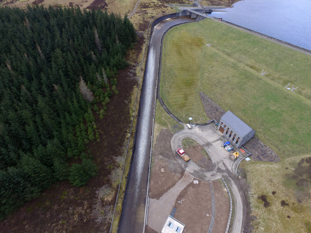
A land survey is a key marker at the start of almost every construction and infrastructure project and having it done accurately is paramount. At Pathfinder we combine traditional topographic survey technology and modern drone survey techniques to produce a cost and time effective solution.
Trained and Competent Operators
Our staff are surveyors first and foremost, drone operators second. That means you can rest assured that while using drone surveys may be new, the concepts and knowledge behind the data are the same.
Our staff are qualified to fly under the CAA (Civil Aviation Authority)
Our operatives come with a CSCS card and the experience to back up our promises. Our team is first aid trained and our vehicles carry first aid kits and fire extinguishers to ensure that we are ready to react to any emergency.
Technology Focused
As a technology first company our commitment to investment in cutting-edge solutions is a given. Our fleet includes a suite of drones with bespoke specifications flown by experienced, specialist pilots.
This flight team is, in turn supported by processors with cutting-edge in-house CAD and DTM modelling software to ensure your project data is delivered smoothly and efficiently.
Producing 2D and 3D data allows us to produce data for any CAD suite your workflow demands, allowing seamless integration into your existing workflows.
Cloud Collaboration
The use of full 3D data provided by drone surveys allows better coordination between contractors, clients and other stakeholders in any project.
As a technology focused company, we always aim to deliver cross sector benefits to improve the value we deliver to clients and improve the development of both built environment and engineering projects.
Full cloud integration allows your project staff and stakeholders to view, engage and integrate their own workflows into one seamless platform.
Limiting your workflow to dated systems with limited sharing potential can cause a huge range of issues – feel free to ask about our cloud platform to see if it could benefit your project.
Photogrammetry vs LIDAR
At Pathfinder we provide a range of solutions. The two main aerial survey technologies currently are photogrammetry and LIDAR.
Photogrammetry involves taking photos and running them through software which then allows you to build a 3D model in the form of point cloud or mesh files.
LIDAR drone surveys involve using laser beams to take direct measurements from the angle and laser range finder payload to produce the point cloud through a “direct measurement”.
Photogrammetry is the most readily available solution and usually delivers a most cost effective solution whereas LIDAR comes at a higher price point but can counter some of situations in which photogrammetry falls short.
Both photogrammetry and LIDAR have their own advantages and Pathfinder assess the pros and cons of each and advise on the most reliable and cost effective solution for your use case.

Delivering full surveying solutions
This combination of specialist drones and pilots, investment in software and systems and a commitment to deliver the very best data ensures we deliver the highest quality and most and cost-effective solutions for any aerial surveying or inspection project.
- Traditional surveys
- Terrestrial scanning
- Aerial photogrammetry
- Aerial LiDAR
- Topographic surveys
- Measured building surveys
- Schedule of conditions.
- Terrain modelling and cut/fill analysis using a combination of drone survey technology combined with traditional GNSS and total station equipment to produce hybrid methodology models with superior accuracy.
- Mobile mapping
Drone Site Surveys
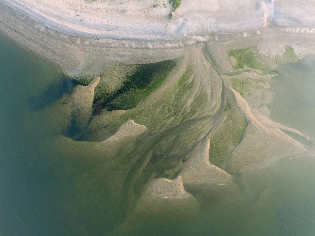
Our drone surveys support land surveying, mapping and condition surveys on active and complex sites. Using unmanned aerial vehicles, we collect accurate drone survey data across large areas with speed and control. This approach allows us to capture high resolution images and detailed survey data without placing staff in unsafe positions.
Each drone survey is planned around access, airspace, and site operations. Our drones equipped with high resolution cameras and thermal cameras allow us to record both visual detail and heat signatures where required. The data collected is processed in-house to produce clear outputs such as elevation models, land mapping files and reports ready for engineering use.
For many businesses, this method provides a cost effective alternative to traditional surveying methods that require long site time, traffic control or heavy access equipment. Our aerial drone surveys reduce risk, improve efficiency and provide reliable data that supports informed decisions.
Drone Surveys and Roof Inspection Services
Roof inspections and structural inspections often involve risk, access limits and high cost. Our drones allow commercial roof inspections and condition checks to be conducted without the need for cherry pickers or scaffolding. This keeps disruption low and improves safety on busy sites.
Using high resolution cameras and aerial photography, we can record roof condition, drainage issues and signs of water ingress. Where required, thermal surveys can be carried out using thermal imaging to help identify heat loss and hidden defects within roof systems and buildings.
These drone surveys are suitable for factories, warehouses, offices, historic buildings and rail infrastructure. The drone data provides clear imagery and records that can be shared with consultants, insurers and project teams as part of planned maintenance or asset inspections.
Independent Roof Surveys
Independent roof surveys provide clear, impartial information for owners, managers and project teams. Our aerial drone surveys record high resolution images and comprehensive data so issues can be reviewed without repeated site visits. This helps many businesses plan repairs, set budgets and manage risk with confidence.
Because our drones operate from safe positions on site, inspections can be conducted with minimal disruption to daily activity. This is especially useful for live sites where traffic flow, staff movement or ongoing works must continue without delay.
All surveys are fully insured and supported by professional indemnity insurance. This gives clients confidence that the survey data, reports and advice are backed by proper standards and clear responsibility.
Benefits of Drone Surveying in Construction
In construction, drone surveys improve efficiency and control costs. A single flight can cover large areas that would otherwise require expensive and time-consuming traditional surveying methods. This makes the drone survey cost effective while still delivering high quality data.
Drone technology also reduces the need for repeated access to unsafe or busy areas. By relying on aerial surveys and precise imagery, teams can review progress, check quantities and confirm details from the office. This limits delays and supports better planning across the project.
The same approach applies to cut and fill checks, land mapping and site reviews. The necessary data is captured quickly, processed in-house, and issued in a format that fits your workflow.
Created for Surveyors, by Surveyors
Our team are surveyors first, and drone operators second. That means every drone survey is planned, flown and reviewed with surveying standards in mind. We focus on accuracy, clear methods and outputs that fit real project workflows.
We invest in cutting edge technology, high resolution cameras and modern processing tools to ensure the data is reliable and usable. The drone technology is only part of the service. The real value comes from how the data is checked, processed and presented.
This approach allows us to support land surveying, mapping, inspections and construction services across the UK with a consistent standard of quality and control.
How Can Drone Surveys Help My Project?
Drone surveys support planning, design, data collection, inspection and reporting at every stage of a project. They reduce time on site, limit risk, and provide accurate data for teams who need to make decisions quickly.
With cutting edge drone technology and controlled processes, we deliver data that supports safe, efficient operations. If you want to review costs, improve access to information, or gain a clearer view of your site, our team is ready to help.
Speak to us about your project and we will explain how our drone surveys can provide the right level of detail, with minimal disruption and dependable results.
Related Services
Inspections & Surveys
Infrastructure, FM & Utilities
Environmental Contracting & Landfill
Areas Covered
We cover a range of areas including the following: