What is Drone Topographic Survey UK? A Guide to Topo Surveys
A topographic survey (also commonly known as a topo survey for short) is a detailed mapping of the natural and man-made features on a piece of land. This includes elevation changes, bodies of water, trees, buildings, and more.
- Centimetre accurate drone surveys and inspections – for all industries
- Highest safety standards – fully insured with £5m Public Liability
- Comprehensive and reliable data from industry leading reporting software
Call 01329 887 337 for more information or to request your fast, no-obligation quote.
Topographic Surveys
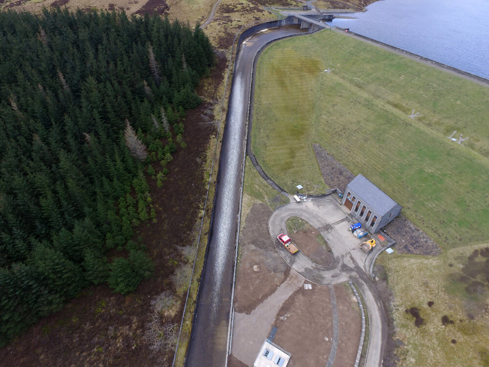
Topographic surveys are used in construction, development, and building projects. They help engineers and architects design safe and efficient structures. These surveys can also be used to assess environmental impacts of construction projects
Topographic surveys are usually conducted by qualified land surveyors. The surveyor uses specialised equipment to measure the land surface. The data from the survey is then used to create a map or other visual representation of the land.
These surveys are often necessary for the planning and construction of new structures or landscaping projects. Without a topographic survey, it would be difficult to accurately predict how excavations or grading may impact drainage patterns or the stability of a site.
They can also provide valuable information about potential hazards or areas that may require special attention during construction. In short, topographic surveys give landowners and builders crucial insights into the characteristics and topography of their land before starting any new projects. Without one, unexpected surprises could lead to costly delays or even dangerous situations. Overall, topographic surveys are essential tools in ensuring successful and safe development plans for any property.
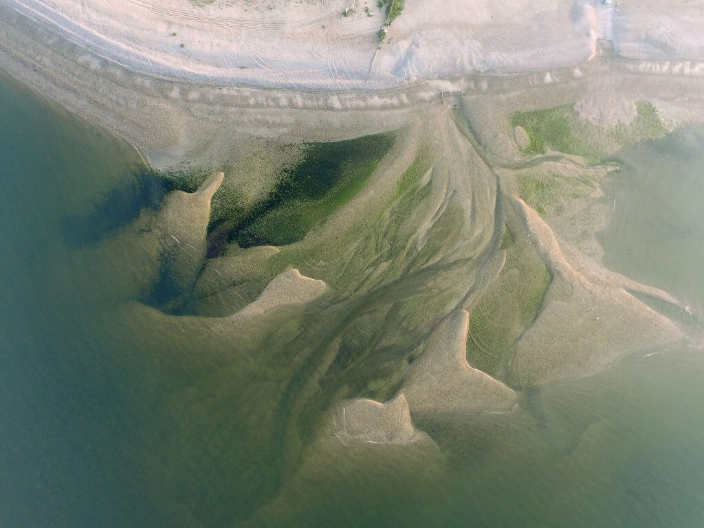
Drones have revolutionised the surveying industry thanks to their ability to take high resolution aerial photographs. Through photogrammetry techniques, these photographs can be used to create 3D point clouds to generate topographic maps, calculate volumes of stockpiles, as well as measure distances and dimensions of features.
Drones are also able to reach locations that may be inaccessible or unsafe for surveyors on foot, making them particularly useful for surveying harsh terrain or areas which contain lots of heavy moving plant.
Drones also offer a cost-effective alternative to traditional surveying methods, covering large areas in a short amount of time with minimal manpower. Overall, the use of drones in survey has greatly improved efficiency and safety in the field.
There are several types of drone surveys used in a variety of industries, each with their own strengths and applications.
How Topographic Surveys Support Project Planning
A clear understanding of site conditions is essential before any construction or engineering work begins. A topographic survey provides this foundation by giving teams accurate land information that supports design, drainage control and safe earthworks planning. These surveys reduce guesswork and give project managers the confidence to make informed decisions at each stage of the build.
Topographic data also supports early risk checks. Slopes, uneven ground, water channels and unseen changes in height can impact works if not identified. By supplying accurate ground levels and detailed surface data, we help project teams plan ahead, manage site activity and control potential issues before they arise.
For development sites, this information often becomes part of ongoing design work. Engineers can use the data to review options, study constraints and prepare layouts that suit the natural conditions of the land. Our work supports this process by delivering clear, structured information in formats that fit standard engineering workflows.


Benefits of Drone Technology in Topographic Mapping
Drone systems continue to improve the way topographic surveys are carried out. The combination of aerial coverage and precision sensors means large sites can be surveyed at speed without placing people in difficult or unsafe locations. This makes drone-based surveys especially suitable for active construction areas, quarries, waste sites and uneven ground.
The aerial view also supports clear visual interpretation of the land. High-resolution images, combined with photogrammetry or other measurement tools, allow detailed surface modelling. This leads to improved levels of accuracy and strong reporting quality. For clients working to tight deadlines or restricted access periods, this approach provides a practical and time-effective solution.
Stockpile volumes, cut and fill checks and surface changes can also be measured with greater consistency. Regular drone flights give project teams reliable comparative data, helping them track progress, assess material movement and support planning decisions throughout the work cycle.
Why Clients Choose Us for Topographic Surveys
We support contractors, developers and asset owners who need clear and reliable topographic information. Our work is carried out using advanced drone systems, experienced survey staff and strong data processing capability. The result is accurate information delivered in formats that support design, planning and reporting.
We also provide clear guidance on the best approach for each site. Because we use both aerial and ground-based tools, we can recommend the most effective option for accuracy, cost and delivery time. Our focus is to give clients a practical solution that fits their project requirements without unnecessary delays or expense.
If you need a professional topographic survey for your next project, we are ready to support you with accurate data, safe operations and fast turnaround. Contact us today to discuss your site or request a no-obligation quote.

Photogrammetry
Photogrammetry uses overlapping pictures taken from the drone to generate measurements and 3D models. This method can be used for both aerial mapping and building inspections.

Lidar
is a technology that uses laser pulses to accurately measure the distance between objects. Lidar is often used in topographic surveys or for creating high resolution models of complicated structures such as bridges or power lines.
As drone technology continues to advance, new survey methods are being developed and utilised in industries such as construction, agriculture, and forestry.
Drones offer unique advantages over traditional surveying techniques, including cost savings and increased safety for surveyors. No matter the project, it’s important to choose the right type of drone survey for accurate, efficient results.
At Pathfinder we run a variety of equipment, not only drones but traditional survey equipment as well, to ensure we provide a turnkey solution to your survey problems. You can see the list of equipment that we run here.
As a RICS Technology Partner, we pride ourselves on advising you on both the best and the most cost-effective solutions for your project. We can provide comprehensive advice to solve any problems you encounter whilst undertaking your projects and allow you to progress.
FAQs for Topographic Surveys
What is a drone topographic survey?
A drone topographic survey is a method of mapping land using aerial data captured from an unmanned aircraft. We collect high-resolution imagery and process it into accurate surface models, contours and mapped features. This allows you to understand ground levels, structures and site conditions before work begins.
At Pathfinder Drone, we combine aerial capture with surveying knowledge gained from years in construction and engineering. The result is structured data that supports design, planning and reporting. It is not just imagery, but usable survey information delivered in formats your team can work with.
How accurate is a drone topographic survey?
Accuracy depends on the equipment used and how the survey is controlled on site. We operate RTK-enabled drone systems and apply proper ground control where required to achieve centimetre-level precision. This ensures the data is suitable for professional engineering and construction use.
Because our team are surveyors first, we understand how accuracy impacts design and earthworks. We assess each site carefully to determine the correct approach. Our aim is always to provide dependable data that supports safe and confident decision making.
What is included in a topographic survey?
A topographic survey typically includes ground levels, contours, buildings, boundaries, hardstanding, vegetation and other visible site features. The output may include 2D drawings, 3D models, point clouds and surface data depending on your needs. We agree on the required deliverables before work begins.
For more complex sites, we can also integrate aerial data with terrestrial survey equipment. This hybrid approach improves detail and reliability in critical areas. Everything is processed in-house to maintain quality control and consistency.
Do I need a topographic survey before building work starts?
In most cases, a topographic survey is essential before starting construction or development work. It provides a clear understanding of levels, slopes and constraints that may affect design or drainage. Without it, design assumptions can lead to delays or costly revisions.
We regularly support contractors and developers at early planning stages. Having accurate land data from the outset allows project teams to plan earthworks, manage risk and coordinate more effectively. It is a practical step that protects both budget and programme.
What is the difference between LiDAR and photogrammetry?
Photogrammetry uses overlapping images to create a 3D surface model from aerial photography. It is often a cost-effective option and works well on open sites with good visual texture. LiDAR uses laser pulses to measure distances directly and can perform better in areas with vegetation cover.
We assess each project to decide which method best suits the terrain and end use. In some cases photogrammetry provides excellent results, while in others LiDAR offers advantages. Our role is to guide you towards the most reliable and appropriate solution.
How much does a topographic survey cost in the UK?
The cost of a topographic survey varies depending on site size, complexity and the level of detail required. Access conditions, vegetation cover and reporting format also influence pricing. We provide clear, no-obligation quotations once we understand your project scope.
Our focus is to deliver value through accuracy, safety and efficient data capture. By combining drone systems with surveying expertise, we aim to keep costs proportionate to the outcome you need. You can contact us directly to discuss your site and receive a personalised estimate.

Related Services

Inspections & Surveys
State-of-the-art UAVs and hi-resolution 4k imaging deliver live on-the-ground feed capability, orthomosaics, improved reporting and complex data analysis.
Infrastructure, FM & Utilities
Infrastructure investments, buildings, windfarms, solar installations, electrical, water, radio and mobile installations all demand high level inspection and monitoring surveying.
Environmental Contracting & Landfill
With specialist experience in environmental contracting and landfill, our UAV operators can quickly, simply and safely overcome all manner of access issues from steep slopes and sheer edge projects to imagery in open water.