Topographic Survey London
CAA Accredited pilots approved for commercial operations.
- High accuracy drone surveys and inspections – for all industries
- Highest safety standards – fully insured with £5m Public Liability
- Comprehensive and reliable data from industry leading reporting software
Call 01329 887 337 for more information or to request your fast, no-obligation quote.
Topographic Survey London
At Pathfinder Drone, we provide accurate and efficient topographic survey services in London for construction, engineering, land development, and infrastructure projects. We combine proven survey methods with advanced aerial and terrestrial technology to give you clear, dependable data for informed planning.
Our team comes from surveying, construction, and civil engineering backgrounds, so we understand the demands of live sites and complex projects. That means you get a practical service, reliable data, and a survey approach shaped around real site conditions and project goals.


Chat with us about how drone surveys can help your business
Topographic Surveys Backed by Surveying Experience
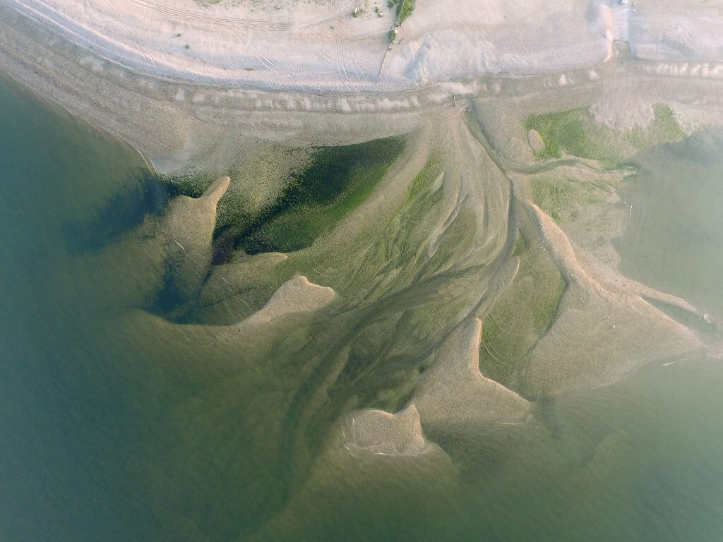
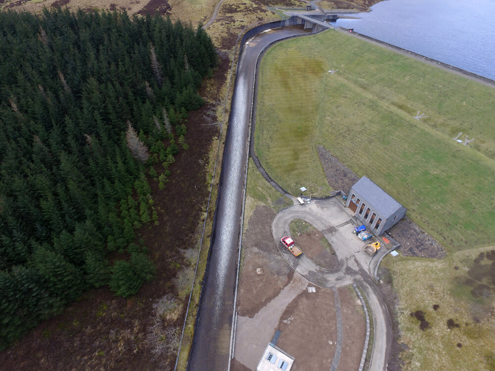
A topographic survey is one of the first and most important steps in any project involving land, design, or site planning. It gives you a clear record of levels, features, boundaries, structures, and ground conditions so your team can move forward with confidence.
In a city like London, survey work often comes with access limits, busy surroundings, and strict project timescales. That is why we use a mix of drone survey technology, GNSS equipment, total station methods, and in-house processing to collect the right data for each site.
At Pathfinder Drone, we are surveyors first and drone operators second. That matters because topographic survey work is not just about collecting images. It is about producing accurate, usable information that supports planning, design, measurement, and reporting.
A Smarter Way to Complete Topographic Survey in London
Our topographic survey helps reduce time on site while still delivering the level of detail your project team needs. By capturing data from above and combining it with ground control where needed, we can work quickly and safely across a wide range of sites.
This approach is especially useful on sites where traditional access is difficult, where vehicle movement is constant, or where large areas need to be measured efficiently. It also helps limit disruption, which is a major benefit on active construction and infrastructure sites across London.
We produce data that can support CAD workflows, modelling, planning, and earthworks analysis. From detailed surface models to point clouds and mapped outputs, our aim is to give you survey information that is clear, dependable, and ready to use.

Why Clients Choose Pathfinder Drone for Topographic Surveys
We bring together more than 50 years of traditional construction and engineering knowledge with modern aerial and terrestrial survey methods. That allows us to choose the right solution for your site instead of forcing one method onto every project.
Safety is central to the way we work. Our pilots are CAA accredited for commercial operations, and we carry £5m public liability insurance. Our team is also first aid trained and experienced in working on demanding commercial and industrial sites.
As a family-run business, we care about doing the job properly and giving clients a service they can rely on. From the first conversation to final delivery, we focus on quality, professionalism, and practical support so you receive survey data that adds real value to your project.
Speak to Us About Your London Survey Project
If you need a topographic survey in London, speak to Pathfinder Drone today. We will look at your site, your project needs, and the best way to deliver accurate data at a fair cost. Contact our team for clear advice and a fast, no-obligation quote.
Contact Us
6 The Gardens Office Village, Fareham, Portsmouth, Hampshire PO16 8SS
Related Services

Inspections & Surveys
Infrastructure, FM & Utilities